
Osito Drone
FAA PART 107 CERTIFIED & INSURED | SAN FRANCISCO BAY AREA

PRECISION FROM ABOVE. TAILORED FOR YOUR MISSION.

From complex industrial inspections and progress mapping to cinematic aerial cinematography and bespoke engineering payloads, Osito Drone Services delivers FAA Part 107 compliant, enterprise-grade aerial solutions across the San Francisco Bay Area.
GET QUOTE CONTACT US
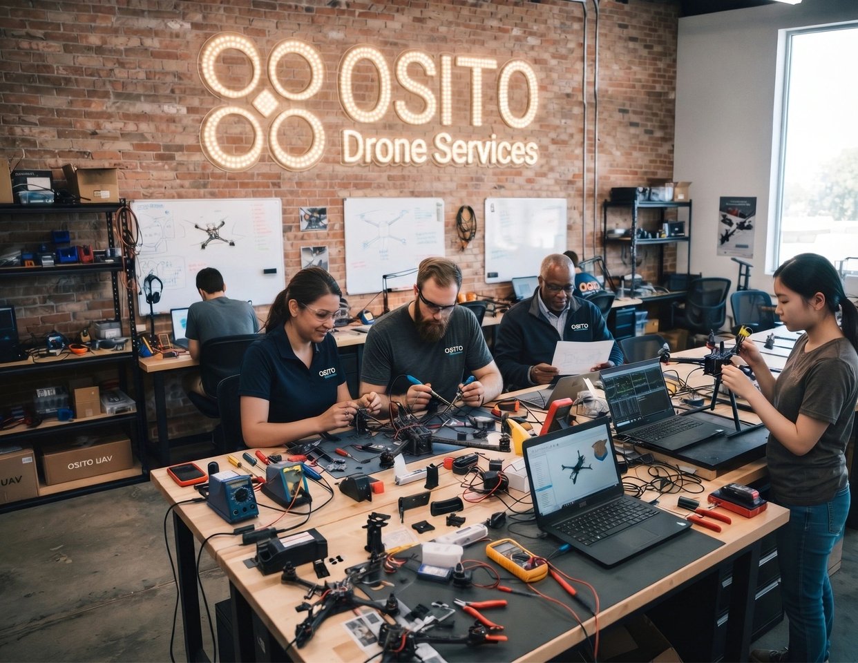
Team assembling and testing drones in a modern workspace

WHY CHOOSE OSITO'S CUSTOM AERIAL SOLUTIONS?

Every mission is unique. Off-the-shelf drone packages rarely meet the rigorous demands of modern commercial, construction, or technical operations. At Osito Drone Services, we combine advanced hardware configuration, expert flight planning, and rigorous safety protocols to build aerial workflows designed around your exact objectives.

FAA Part 107 Certified & Insured Fully compliant commercial pilots with strict adherence to airspace authorizations and safety redundancies.
Mission-Specific Payload Integration Custom camera goggle setups, high-resolution orthomosaics, thermal imaging, and agile FPV navigation.
End-to-End Execution From initial site risk assessment and airspace clearance to raw data delivery or cinematic post-production.
NEW YEAR SPECIAL | 25% OFF TILL JAN 1

FAA PART 107 AERIAL & THERMAL MISSIONS STARTING AT $296+ (REG. $395+)

Beat Bay Area commercial drone minimums ($395-$750) by 25% to 60% with 24-hour turnaround on 4K roof, thermal, orthomosaic, and real estate flights.

GET QUOTE ($296+)

CORE AERIAL SERVICE PILLARS

1. CONSTRUCTION PROGRESS & SITE MAPPING

Keep stakeholders informed and projects on schedule with millimeter-accurate aerial intelligence.

  • High-Resolution Orthomosaics: 2D and 3D terrain modeling for precise site surveying.
  • Volume & Stockpile Calculations: Accurate earthwork and material measurement.
  • Progress Timelapses: Regular scheduled flights to document milestones from groundbreaking to completion.

2. COMMERCIAL REAL ESTATE & CINEMATIC CINEMATOGRAPHY

Showcase properties and spaces from breathtaking, perspective-shifting angles.

  • 4K/6K Aerial Video & Photography: Crisp, stabilized exterior and neighborhood overviews.
  • Interior/Exterior FPV Tours: Immersive, continuous flight paths through commercial spaces, open houses, or sprawling grounds using custom micro-FPV drones.
  • Marketing-Ready Edits: Professionally graded footage ready for your website, listings, and social media.

3. INDUSTRIAL & INFRASTRUCTURE INSPECTION

Reduce downtime and eliminate worker safety risks with close-up aerial assessments.

  • Roof, Facade, & Tower Checks: High-zoom detail capture to identify wear, damage, or maintenance needs.
  • Thermal & Infrared Analysis: Detect heat loss, electrical inefficiencies, or structural anomalies.
  • Hard-to-Reach Areas: Safe navigation around complex architectural or industrial geometries.

4. CUSTOM R&D & BESPOKE CLIENT SOLUTIONS

Have a unique operational challenge? We engineer custom solutions.

  • Specialized Payloads: Integration of custom sensors or 3D-printed carbon-nylon equipment mounts.
  • Proof-of-Concept Testing: Rapid prototyping and controlled test flights for tech companies, event organizers, and municipal partners.

RECENT SAN FRANCISCO & BAY AREA AERIAL MISSIONS

Captured directly by the Osito Drone Services flight crew across San Francisco, Treasure Island, Twin Peaks, and the Hunters Point waterfront:
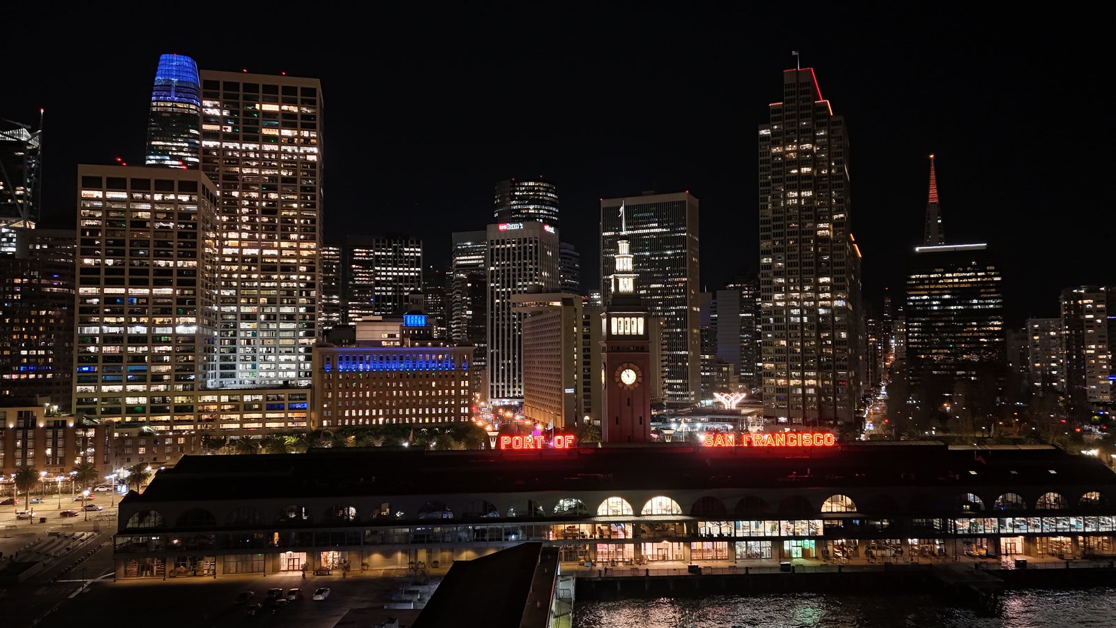
Port of San Francisco Ferry Building at Night
NIGHT CINEMATOGRAPHY | EMBARCADERO

Port of San Francisco Ferry Building & Skyline

Low-noise night aerial capture of the illuminated Ferry Building clock tower and Financial District.
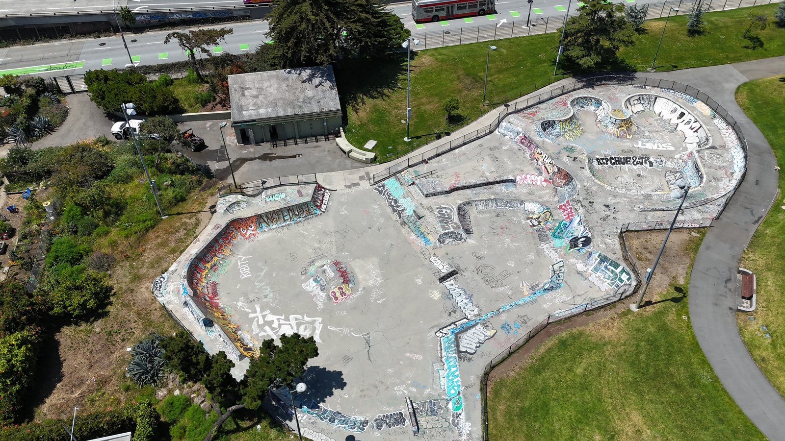
90-Degree Nadir Skatepark Orthomosaic Survey
90-DEG NADIR ORTHOMOSAIC | SITE MAPPING

Top-Down Concrete & Drainage Geometry Survey

Vertical 90-degree photogrammetry and surface inspection of San Francisco skatepark bowls.
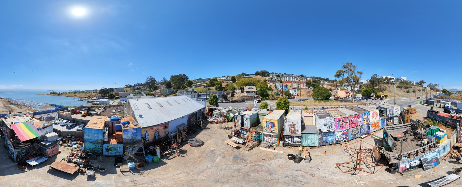
120MP Hunters Point Box Shop Mural Compound
120MP PANORAMIC SURVEY | HUNTERS POINT

Industrial Yard & Waterfront Mural Compound

Ultra-high-resolution 120-megapixel panoramic inspection of San Francisco industrial arts yards.
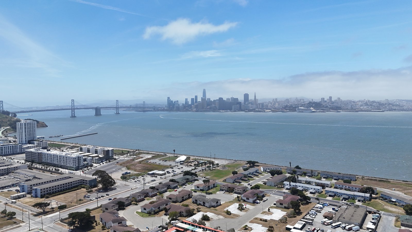
Treasure Island to Bay Bridge Aerial
CORRIDOR & WATERFRONT | TREASURE ISLAND

Treasure Island & SF-Oakland Bay Bridge

Wide-horizon infrastructure and development progress view across the Bay Bridge to Downtown SF.
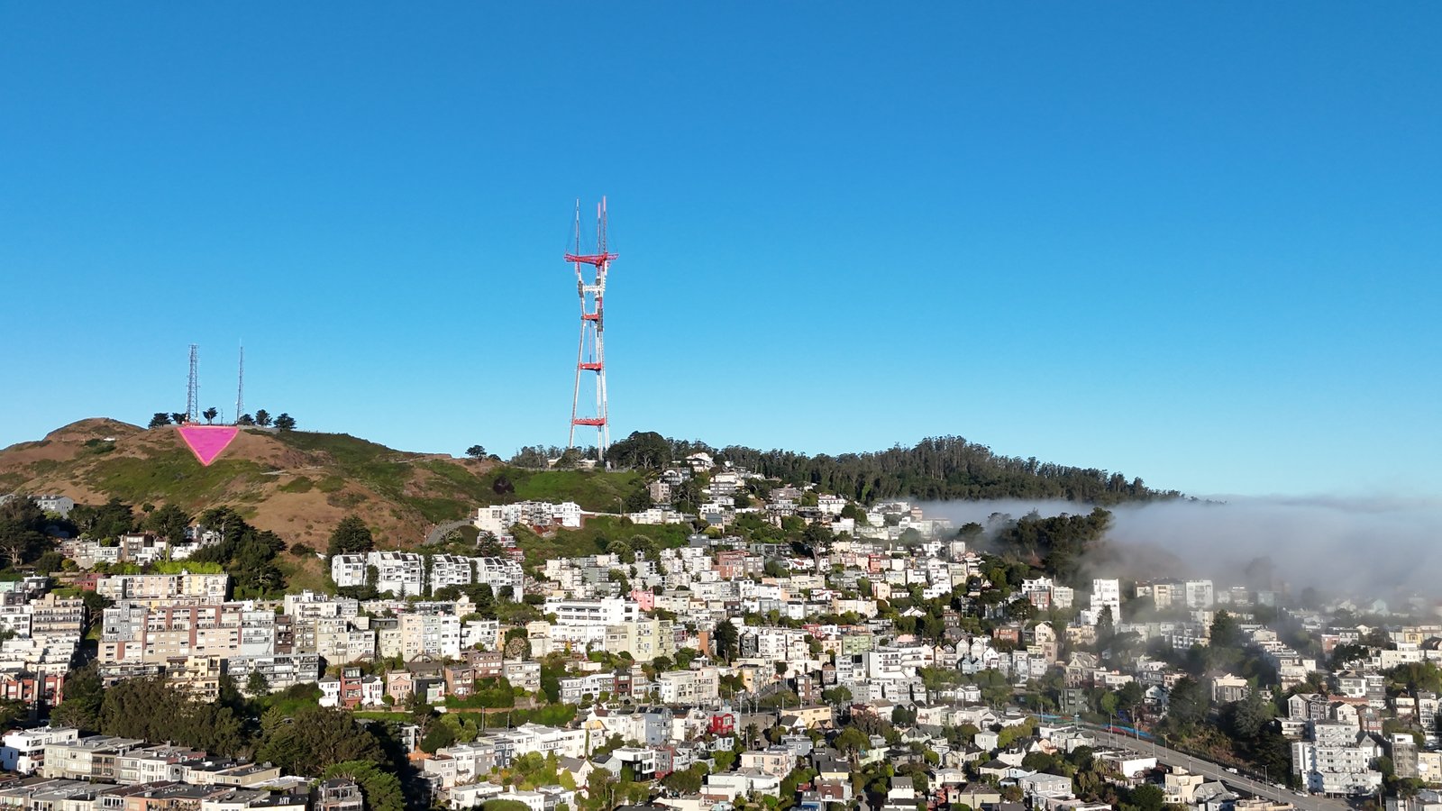
Sutro Tower and Twin Peaks Coastal Fog
TOWER & ELEVATION | TWIN PEAKS

Sutro Tower & Hillside Residential Roofscapes

High-clarity daytime aerial over Twin Peaks and San Francisco hillside neighborhoods.
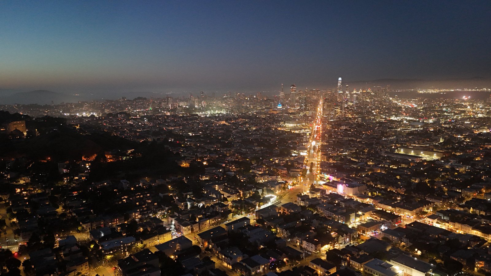
San Francisco Night Grid and Bay Bridge
URBAN ILLUMINATION | SAN FRANCISCO

San Francisco Arterial Night Grid & Bay Bridge

High-altitude night flight documenting municipal lighting corridors and downtown visibility.

OUR SAFETY & COMPLIANCE GUARANTEE

At Osito Drone Services, safety isn't an afterthought - it's our operational baseline. Every flight follows a strict protocol:

Pre-Flight Airspace & Weather Analysis Checking LAANC, NOTAMs, wind shear, and solar activity before every deployment.
Comprehensive Site Risk Assessment Identifying obstacles, pedestrian zones, and emergency abort paths.
Equipment Redundancy Checks Routine telemetry, battery health logs, and fail-safe return-to-home verification.

LET'S BUILD YOUR NEXT AERIAL MISSION

Whether you need a one-time promotional shoot or a recurring infrastructure mapping contract, Osito Drone Services is ready to deliver precision from above.

REQUEST QUOTE